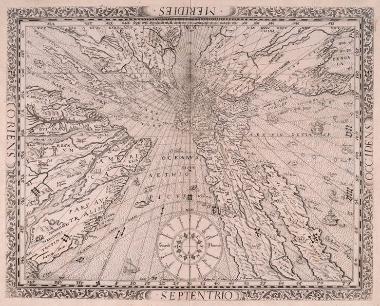
Plate 23
Franz Ritter, German, d. 1641
Untitled map of the Northern Hemisphere (1610)
11⅝ x 14⅛ in. (29.5 x 36 cm)
Nuremberg, Germany, 1640
Known as the Sundial Map, this is mathematically correct. It has been is drawn to a scale determined by distance from the pole. The limitation here is, clearly, only the size of the sheet on which the map can be printed.