Communication and Transportation
[Below] “The Electric and International Telegraph Company’s Map of the Telegraph Lines of Europe, 1856” (London: published under the authority of the Electric Telegraph Company, by Day & Son, lithrs. . . . , August 1, 1856). Lithograph map, mounted on linen, 68 × 97 cm, on sheet 76 × 112 cm [Historic Maps Collection].
Sending messages with electrical signals developed quickly in the 1830s and became practical and commercial in the 1840s. Founded in Great Britain in 1846, the Electric Telegraph Company was the world’s first public telegraph company. It merged with the International Telegraph Company, an English-Dutch venture begun in 1852, in 1855. This is the first map of the consolidated company, showing the extent of the burgeoning communications system. Current and future telegraph lines are shown in full and dotted red lines; all of the English and Continental stations, between which messages can be sent, are indicated with red circles and listed on the map’s margins. According to the note at the top right, messages to and from the Continent had to be addressed “via Amsterdam.”
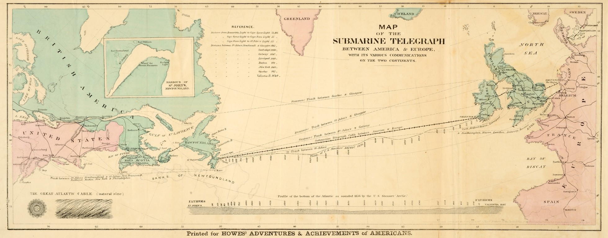
Henry Howe, 1816–1893. “Map of the Submarine Telegraph between America & Europe, with the Various Communications on the Two Continents.” Printed map, with added color, 17.2 × 45.6 cm. Frontispiece to his Adventures and Achievements of Americans: A Series of Narratives Illustrating Their Heroism, Self-Reliance, Genius and Enterprise, illus. by F.O.C. Darley and others (New York: Geo. F. Tuttle; Cincinnati: H. Howe, 1858) [Graphic Arts Collection].
Beginning his story with Nathan Hale, martyr of the American Revolution, Howe builds up to, and concludes with, a chapter on “The Atlantic Telegraph.” “It is a happy circumstance that a volume like this can be closed by an account of the rise, progress, and completion of the great work which is properly regarded as the crowning triumph of scientific discovery and mechanical ingenuity” [p. 653]. The first transatlantic telegraph cable was laid in the late summer of 1858, linking Newfoundland to Valentia Island, off Ireland’s southwest coast. Hence, Howe’s work was extraordinarily current.

