“Ikmalick and Apelagliu” [on stone by J. Brandard from original drawing by John Ross]
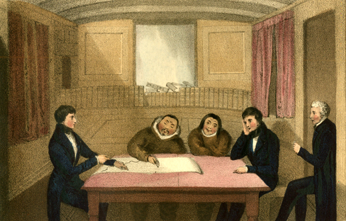
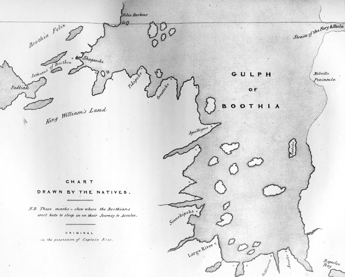
The promised hydrographer, Ikmallik, came to us this morning, accompanied by Tiagashu, and they were taken into the cabin; six others who attended them being turned over to the care of the men. . . . Some paper containing a sketch of the land already known between Repulse bay and Prince Regent's inlet, was now laid before them, with the names of the different places marked. These were at once regonised; and Ikmallik then taking the pencil, proceeded to prolong the sketch from Akullee, following very nearly, for a very considerable space, the line already traced by Tulluahiu. After this, he prolonged it still further westward, instead turning to the north, as the latter had done; then continuing it to the north-west, in a direction more favourable to our views. He did not, however, insert the islands; nor could we discover how many days it was estimated from the end of his chart to Akullee near Repulse bay; but he drew Wager bay and its river very correctly, making also several other rivers. He further gave us to understand that our ship could sail that way till the autumn; and with this information we were obliged, for the present, to be content. [Ross, pp. 259-260.] [see the resulting map, “Chart Drawn by the Natives”]