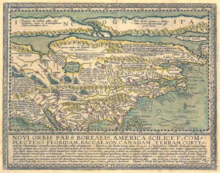
"Novi Orbis Pars Borealis, America Scilicet, Complectens Floridam, Baccalaon, Canadam . . ." [1600]. Copperplate map, 16.2 x 27.2 cm. (map area inset within wider border), handcolored. This is the only known state of the map. From Quad's Geographisch Handtbuch, which was the first world atlas produced by a German author. [Historic Maps Collection: purchased with funds provided by Robert M. Backes, Class of 1939.]
Essentially, Quad offers an attractive, smaller version of a map issued by Cornelis de Jode (1568-1600) in 1593. The most striking and obvious feature of this map is its implication of a clear, unobstructed Northwest Passage across the top of the North American continent. The waterway visually separates the unvisited "Incognita" parts from those more recently "discovered," hence neatly divides the literal from the imagined. The largest lake on the map, Lago de Conibas, empties into Arctic waters, but it is in an area still unexplored by Europeans; hence, it, too, is probably speculative. Though Hudson Bay has not yet appeared, the eastern coastline reflects sixteenth-century explorations of Giovanni da Verrazzano (1485-1528) and Sir Walter Raleigh (1552?-1618).
