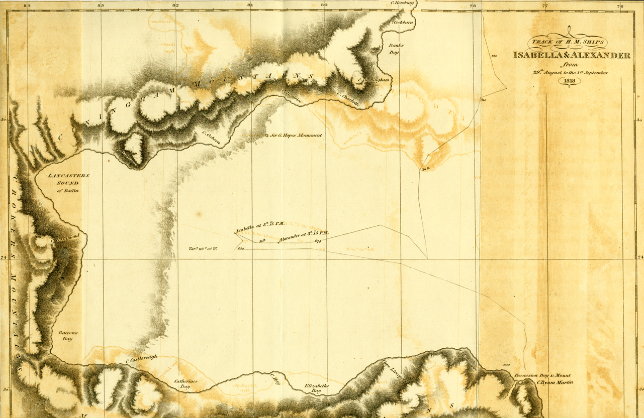
“Lancaster Sound, as seen from H.M.S. Isabella, at 3 p.m. Augt. 31st. 1818” [Sir John Ross]
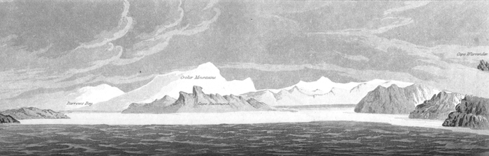
At half past two, (when I went off deck to dinner), there were some hopes of its clearing, and I left orders to be called on the appearance of land or ice a-head. At three, the officer of the watch, who was relieved to his dinner by Mr. Lewis, reported, on his coming into the cabin, that there was some appearance of its clearing at the bottom of the bay; I immediately, therefore, went on deck, and soon after it completely cleared for about ten minutes, and I distinctly saw the land, round the bottom of the bay, forming a connected chain of mountains with those which extended along the north and south sides. This land appeared to be at the distance of eight leagues; and Mr. Lewis, the master, and James Haig, leading man, being sent for, they took its bearings, which were inserted in the log; the water on the surface was at temperature of 34 . At this moment I also saw a continuity of ice, at the distance of seven miles, extending from one side of the bay to the other, between the nearest cape to the north, which I named after Sir George Warrender, and that to the south, which was named after Viscount Castlereagh. The mountains, which occupied the centre, in a north and south direction, were named Croker's Mountains, after the Secretary to the Admiralty. The southwest corner, which formed a spacious bay, completely occupied by ice, was named Barrow's Bay, and is bounded on the south by Cape Castlereagh, and on the north by Cape Rosamond, which is a head-land, that projects eastward from the high land in the centre. The north corner, which was the last I had made out, was a deep inlet; and as it answered exactly to the latitude given by Baffin of Lancaster Sound, I have no doubt that it was the same, and consider it a most remarkable instance of the accuracy of that able navigator. [Ross, pp. 174-175.]
Ross's description of his infamous fictional "Croker Mountains"
which prevented him from proceeding west and discovering the ultimate
gateway of the Northwest Passage. Ironically, his error comes at the
same time that he notes the accuracy of William Baffin's navigation!
