|
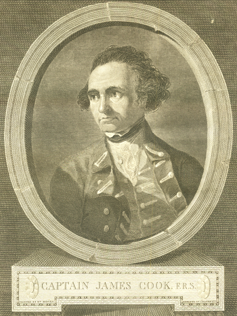
Cook, James, 1728-1779. [portrait]
A Voyage to the Pacific Ocean. Undertaken, by the Command of His Majesty,
for Making Discoveries in the Northern Hemisphere, to Determine the Position
and Extent of the West Side of North America; Its Distance from Asia;
and the Practicability of a Northern Passage to Europe . . . London,
1784. 3 vols. [Rare Books Division]
Among the most important achievements of the great English circumnavigator
James Cook are his detailed surveys of the northwestern coast of North
America in 1778 during his third and last voyage while he sought a Northwest
Passage to the Atlantic from the Pacific. Just months before his untimely
and tragic murder by natives in Hawaii, he had set a “farthest east”
(coming from the west) record in the Arctic: Icy Cape on the Alaskan coast
at a longitude of 198° 20' (east from Greenwich). In fact, as the
first English explorer to visit the Arctic Ocean through Bering Strait,
he established a “farthest north” record there as well, at a
latitude of 70° 44'. During the summer months of 1778, Captain Cook
in his 460-ton ship Resolution, accompanied by Captain Charles
Clerke in the Discovery, trolled along the coast of Alaska and
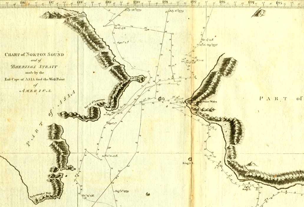
zig-zagged across Bering Strait to Siberia [his
map of this activity]. His journal of his geographical discoveries
clarified many cartographic misconceptions regarding the extent of Asia
and North America and narrowed the possibility of a Northwest Passage.
Excerpts from his journal:
[June 1, 1778.] All hopes of finding a passage were now given up.
. . . The principal information gained by this tide's work, was the
determining that all the low land, which we had supposed to be an island
or islands, was one continued tract, from the banks of the great river,
to the foot of the mountains, to which it joined; and that it terminated
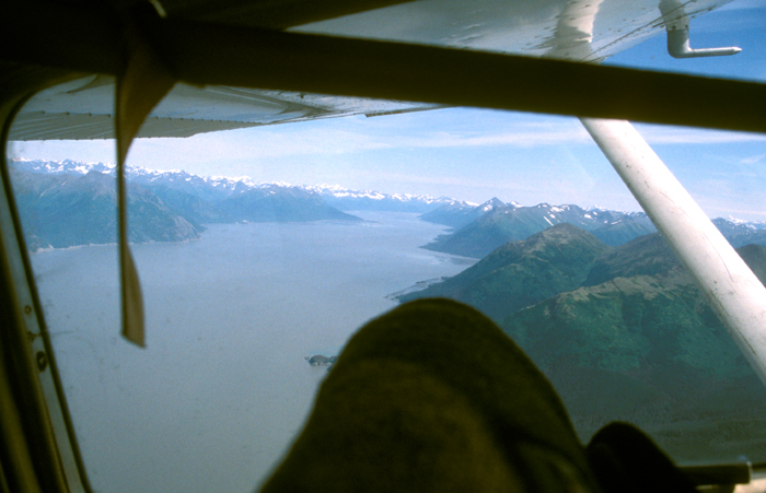
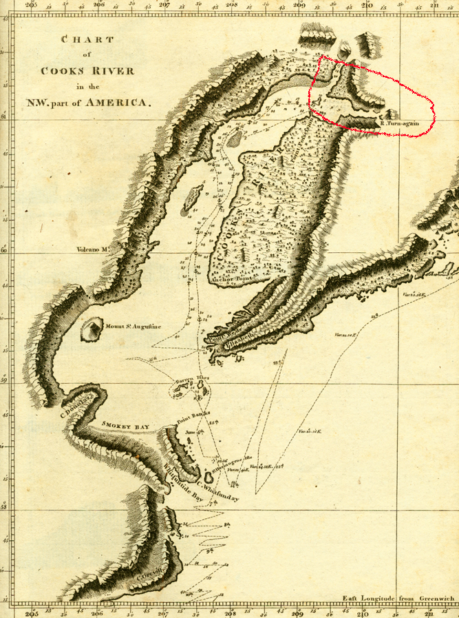
at the South entrance of this Eastern branch, which I shall distinguish
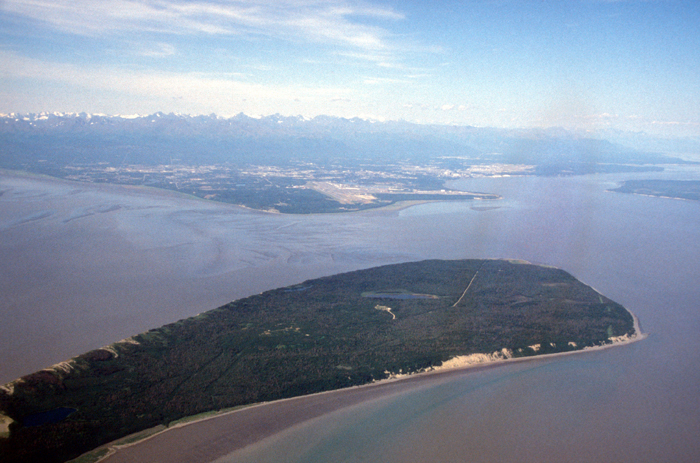
by the name of River Turnagain [2003
photo]. On the North side of this river, the low land again begins,
and stretches out from the foot of the mountains, down to the banks
of the great river; so that, before the river Turnagain, it forms a
large bay, on the South side of which we were now at anchor [his
map of the area vs. 2003 photo of the area,
now Anchorage, Alaska]. [Cook, vol. 2, pp. 394, 395.]
If the discovery of this great river [later named for Cook], which
promises to vie with the most considerable ones already known to be
capable of extensive inland navigation, should prove of use either to
the present, or to any future age, the time we spent in it ought to
be less regretted. But to us, who had a much greater object in view,
the delay thus occasioned was an essential loss. The season was advancing
apace. We knew not how far to proceed to the South; and we were now
convinced, that the continent of North America extended farther to the
West, than, from the modern most reputable charts, we had reason to
expect. This made the existence of a passage to Baffin's or Hudson's
Bays less probable; or, at least shewed it to be of greater extent.
It was a satisfaction to me, however, to reflect, that, if I had not
examined this very considerable inlet, it would have been assumed, by
speculative fabricators of geography, as a fact, that it communicated
with the sea to the North, or with Baffin's or Hudson's Bay to the East;
and been marked, perhaps, on future maps of the world, with greater
precision, and more certain signs of reality, than the invisible, because
imaginary, Straits of de Fuca, and de Fonte. [Cook, vol. 2, pp. 396-397.]
[August 18, 1778.] We gained nothing; for on the 18th at noon, our
latitude was 70° 44'; and we were near five leagues farther to the
Eastward. We were, at this time, close to the edge of the ice, which
was as compact as a wall; and seemed to be ten or twelve feet high at
least. But, farther North, it appeared much higher. Its surface was
extremely rugged; and here and there, we saw upon it, pools of water.
We now stood to the Southward; and, after running six leagues, shoaled
the water to seven fathoms; but it soon deepened to nine fathoms. At
this time, the weather, which had been hazy, clearing up a little, we
saw land extending from South to South East by East, about three or
four mile distant. The Eastern extreme forms a point, which was much
encumbered with ice; for which reason it obtained the name of Icy Cape.
Its latitude is 70° 29', and its longitude 198° 20'. The other
extreme of the land was lost in the horizon; so that there can be no
doubt of its being a continuation of the American continent. . . . Our
situation was now more and more critical. We were in shoal water, upon
a lee shore; and the main body of the ice to windward, driving down
upon us. [Cook, vol. 2, pp. 454-455.]
Cook was forced to retreat from the moving ice, eventually to seek the
warmth of the Sandwich Islands, while still planning to continue his search
for a Northwest Passage in the Arctic the next summer. His death in February
1779 put an end to further English exploration in the area till the next
century. (Cook's crew continued to look for a Northwest Passage the next
summer, but again were stopped by ice not far from where they had given
up the year before. They returned to England in October 1780.)
|