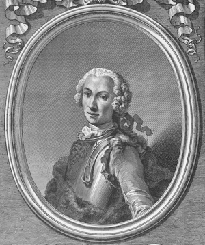
Travels in Egypt and Nubia. Translated from the original by Dr. Peter Templeman. 2 vols. in 1. London: L. Davis and C. Reymers, 1757. [Rare Books Division]

There is something very surprizing in this jealousy, that the Turks and the Arabs shew for their antiquities, whenever they see a stranger come to examine them. This jealousy is so much the more surprizing, as you plainly perceive that they have no great value for them themselves, and if they find too much difficulty to demolish them, they cover over the figures with mud and dirt, and employ these venerable monuments as stalls for their cattle, which fills them with ordure. But as far as one can comprehend, and as I have already insinuated in more than one place, the true cause of this jealousy arises from superstition, which runs through the country, and persuades them, that all foreigners are so many magicians, and that the designs they draw are so many talismans.
—Norden (Vol. II, p. 89)
Norden was a Danish naval officer whose uncommon talent for drawing came to the attention of King Christian VI when he was retouching and amending a collection of charts and topographical plans. In 1737, the king ordered him to go to Egypt on an exploratory mission.
His itinerary—from Alexandria to Cairo to Derri (short of the Nile’s second cataract) and back—took him farther into Nubia than any previous European traveler and provided an unprecedented view of ancient monuments along the Nile River. Everywhere he went, Norden noted dimensions, drew views, and made plans, which he accompanied with descriptive narrative. His study of architecture and his proficiency in mathematics enabled him to sketch accurate representations of what he found. These extensive drawings, made on the spot, offer the earliest glimpses of many Egyptian sites, well before the advent of tourism and excavations.
Norden continued to work on his sketches after he returned to Europe in 1738. However, military duties interfered, and he eventually died of consumption in Paris in 1742. His great accomplishment was published posthumously in France in 1755 as Voyage d'Egypte et de Nubie. In it, Norden’s chart of the Nile occupies 29 of the more than 160 plates, surpassing all previous maps of the river: the first entirely based on the observations of an eye-witness.